The Unique Maps Co.
Old Map of Walcheren Island, Zeeland by Visscher, 1690: Middelburg, Vlissingen, Domburg, Veere, Koudekerke
Old Map of Walcheren Island, Zeeland by Visscher, 1690: Middelburg, Vlissingen, Domburg, Veere, Koudekerke
Couldn't load pickup availability
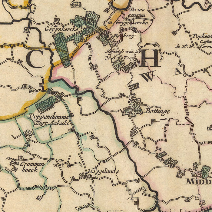
Introducing the 'Walchria Insula Zelandiae', a stunning representation of Walcheren Island in Zeeland, an area that is now part of the modern-day Netherlands. Crafted meticulously by Nicolaes Visscher II in 1690, this map captures the essence of the Dutch Golden Age of cartography, a period when the Dutch were the leading mapmakers of the world. The full name of the map translates to 'Walcheren Island of Zeeland', giving us a clear indication of the regions covered in this historical piece.
The map highlights five significant locations: Middelburg, Vlissingen, Domburg, Veere, and Koudekerke. Middelburg, the capital of Zeeland, is prominently displayed, reflecting its historical importance as a bustling trade city. Vlissingen, or Flushing, is another key city, known for its strategic maritime location. Domburg, while smaller, holds historical significance as one of the oldest towns in Zeeland.
Veere, another city featured on the map, was a prosperous trading port in the Middle Ages, known for its Scottish wool trade. Lastly, Koudekerke is depicted, a small village on Walcheren Island, representing the quieter, rural life of the region. Each of these locations provides a glimpse into the diverse aspects of life in Zeeland during the late 17th century.
The 'Walchria Insula Zelandiae' is not just a map, but a historical artifact that tells a story of a time and place that was instrumental in shaping the world as we know it today. This piece would make a valuable addition to any collection, offering a window into the past, and the rich history of the Dutch Golden Age.
Some of the significant locations shown on this map:
Zeeland
- Middelburg: Known as the capital of Zeeland, it was a major trading city during the Dutch Golden Age.
- Vlissingen (Flushing): A strategically important maritime city, known for its shipyards and naval base.
- Domburg: One of the oldest towns in Zeeland, known for its ancient church and Roman ruins.
- Veere: A prosperous trading port in the Middle Ages, particularly known for its Scottish wool trade.
- Koudekerke: A small village on Walcheren Island, depicting the rural life of the region.
- Oostburg: Known for its church tower, the only remnant of a 13th-century church destroyed in WWII.
Notable Natural Phenomena
- Scheldt River: A major river that has played a crucial role in the region's history and economy.
- Grevelingen: The largest saltwater lake in Western Europe, known for its clear water and rich biodiversity.
- Oosterschelde: A large estuary known for its tidal nature and the Oosterscheldekering, a major feat of Dutch engineering.
- Haringvliet: A large body of water, part of the delta formed by the Rhine and Meuse rivers.
- Dunes of Walcheren: These dunes form a natural barrier protecting the island from the sea.
Notable Historical Events (1600-1690)
- Battle of Sluis (1604): An important naval battle during the Eighty Years' War where the Dutch reclaimed Sluis from the Spanish.
- Construction of the Canal through Walcheren (1611-1615): A significant engineering feat to improve the connection between Middelburg and the sea.
- Raid on the Medway (1667): A successful attack on the English navy in the river Medway, during the Second Anglo-Dutch War.
Please double check the images to make sure that a specific town or place is shown on this map. You can also get in touch and ask us to check the map for you.
This map looks great at all sizes: 12x16in (30.5x41cm), 16x20in (40.5x51cm), 18x24in (45.5x61cm), 24x30in (61x76cm), 32x40in (81.5x102cm), 40x50in (102x127cm), 48x60in (122x153cm) and 56x70in (142x178cm), but it looks even better when printed large.
I can create beautiful, large prints of this map up to 90in (229cm). Please get in touch if you're looking for larger, customised or different framing options.
The model in the listing images is holding the 16x20in (40.5x51cm) version of this map.
The fifth listing image shows an example of my map personalisation service.
If you’re looking for something slightly different, check out my collection of the best old maps of Europe and European cities to see if something else catches your eye.
Please contact me to check if a certain location, landmark or feature is shown on this map.
This would make a wonderful birthday, Christmas, Father's Day, work leaving, anniversary or housewarming gift for someone from the areas covered by this map.
This map is available as a giclée print on acid free archival matte paper, or you can buy it framed. The frame is a nice, simple black frame that suits most aesthetics. Please get in touch if you'd like a different frame colour or material. My frames are glazed with super-clear museum-grade acrylic (perspex/acrylite), which is significantly less reflective than glass, safer, and will always arrive in perfect condition.
Share