The Unique Maps Co.
Old Map of the Rhine River by Visscher, 1690: Mouth to Source, Bern, Brussels, Luxembourg, Frankfurt, Cologne
Old Map of the Rhine River by Visscher, 1690: Mouth to Source, Bern, Brussels, Luxembourg, Frankfurt, Cologne
Couldn't load pickup availability
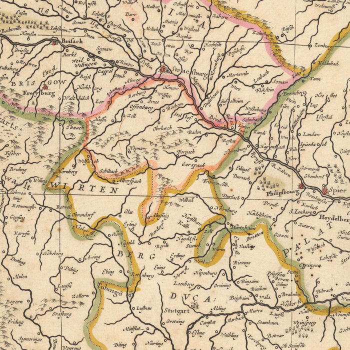
Immerse yourself in the rich history of Europe with this captivating 1690 map of the Rhine River, crafted by the renowned mapmaker Nicolaes Visscher II. The map, originally titled 'Rhenus Fluviorum Europae celeberrimus cum Mosa, Mosella, et reliquis, in illum se exonerantibus, fluminibus', provides an intricate depiction of the political and geographical landscape of the time. Translated, the title reads: 'The Rhine, the most famous of the rivers of Europe, with the Meuse, Moselle, and the rest, which discharge into it'.
The map prominently features the city of Bern, the de facto capital of Switzerland. Bern is beautifully represented, showcasing its historical significance and the strategic importance it held during the period. Also highlighted is Brussels, the vibrant capital of Belgium, known for its rich history and cultural diversity. The detailed depiction of these cities offers a glimpse into their past, providing a historical context that is both informative and fascinating.
Further, the map also includes Luxembourg, a small yet influential European nation. Its strategic location and historical importance are clearly portrayed. Frankfurt, a major German city known for its commercial and economic significance, is another notable feature. The map's depiction of Frankfurt reflects its prominence and influence in the 17th century.
Lastly, the city of Cologne, one of Germany's oldest cities, is beautifully detailed. Known for its rich history and cultural heritage, Cologne's representation in the map underscores its significance during the period. This map, with its meticulous detail and historical accuracy, offers a unique perspective into the political and geographical dynamics of 17th century Europe. It's an exquisite piece that will add a touch of elegance and historical charm to any collection.
Notable natural phenomena and boundaries:
- The Rhine River: A major European river that flows through several countries, offering stunning landscapes and historical significance.
- The Meuse River: Known for its picturesque landscapes, it's a major European river flowing through France, Belgium and the Netherlands.
- The Moselle River: A river flowing through France, Luxembourg, and Germany, known for its vineyards and beautiful landscapes.
- The Black Forest: A mountainous region in southwest Germany, known for its dense, evergreen forests and picturesque villages.
- The Ardennes: A region of extensive forests, rolling hills and ridges in Belgium, Luxembourg, and France.
Notable historical events:
- The Thirty Years' War (1618-1648): A major conflict that significantly impacted the region, leading to shifts in power and territorial boundaries.
- The Franco-Dutch War (1672-1678): A conflict that involved several European powers and led to significant changes in the balance of power in Europe.
- The Nine Years' War (1688-1697): A major conflict between France and a European-wide coalition, the Grand Alliance, led by the Holy Roman Empire, the Dutch Republic, Spain, England, and Savoy.
Please double check the images to make sure that a specific town or place is shown on this map. You can also get in touch and ask us to check the map for you.
This map looks great at all sizes: 18x8in (46x22cm), 24x11in (61x29cm), 36x17in (91x44cm), 45x21in (114x54cm), 50x24in (127x60cm), 60x29in (152x73cm) and 70x33in (178x85cm), but it looks even better when printed large.
I can create beautiful, large prints of this map up to 90in (229cm). Please get in touch if you're looking for larger, customised or different framing options.
The model in the listing images is holding the 24x36in (61x91.5cm) version of this map.
The fifth listing image shows an example of my map personalisation service.
If you’re looking for something slightly different, check out my collection of the best old maps of Europe and European cities to see if something else catches your eye.
Please contact me to check if a certain location, landmark or feature is shown on this map.
This would make a wonderful birthday, Christmas, Father's Day, work leaving, anniversary or housewarming gift for someone from the areas covered by this map.
This map is available as a giclée print on acid free archival matte paper, or you can buy it framed. The frame is a nice, simple black frame that suits most aesthetics. Please get in touch if you'd like a different frame colour or material. My frames are glazed with super-clear museum-grade acrylic (perspex/acrylite), which is significantly less reflective than glass, safer, and will always arrive in perfect condition.
Share