The Unique Maps Co.
Old Map of Mongolia and China, 1967: Korea, Taiwan, Detailed Political and Physical Atlas
Old Map of Mongolia and China, 1967: Korea, Taiwan, Detailed Political and Physical Atlas
Couldn't load pickup availability
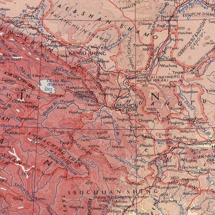
Immerse yourself in the intricate beauty of the 'Mongolia and China' map, a captivating testament to the precision and detail of the Polish Army Topography Service. Crafted in 1967, this map serves as a time capsule, capturing the political and physical landscape of the era. The map's scope extends beyond Mongolia and China, encapsulating other significant regions of Asia such as Korea and Taiwan. Each country is depicted with a meticulous attention to detail, reflecting the mapmaker's dedication to accuracy and precision.
The 'Mongolia and China' map is a remarkable example of a detailed political and physical map. It offers an in-depth perspective of the geographical intricacies of these nations, providing a wealth of information for the discerning viewer. The political boundaries are clearly delineated, reflecting the geopolitical landscape of the time. Similarly, the physical features of the landscape, including the majestic mountain ranges and expansive plains, are depicted with an impressive level of detail. This combination of political and physical mapping provides a comprehensive view of the region, making it an interesting and informative piece.
The mapmaker, the Polish Army Topography Service, was renowned for their rigorous standards and commitment to accuracy. Their expertise is evident in the 'Mongolia and China' map, which is a testament to their meticulous approach to cartography. The map is a reflection of the geopolitical climate of the time, providing a snapshot of the relationships and tensions between these Asian nations. The mapmaker's attention to detail and commitment to precision ensures that this map is not only a work of art, but also a valuable historical resource.
The 'Mongolia and China' map is more than just a depiction of geographical features. It is a rich tapestry that tells the story of these nations, their history, and their relationship with each other and the world. Significant cities and landmarks are clearly marked, offering a glimpse into the cultural and historical significance of these regions. Borders are clearly defined, reflecting the political divisions of the time. This map is not just a representation of physical space, but also a depiction of the historical and political landscape of the time, making it a fascinating piece for any history or cartography enthusiast.
Major Cities in Mongolia: - Ulaanbaatar - Erdenet - Darkhan
Major Cities in China: - Beijing - Shanghai - Guangzhou - Shenzhen - Wuhan - Chengdu - Hangzhou - Chongqing
Major Cities in Korea: - Seoul - Busan - Incheon - Daegu - Daejeon - Gwangju
Major Cities in Taiwan: - Taipei - Kaohsiung - Taichung - Tainan - New Taipei City
National Parks in Mongolia: - Gobi Gurvansaikhan National Park - Khustain Nuruu National Park - Khan Khentii Strictly Protected Area
National Parks in China: - Zhangjiajie National Forest Park - Jiuzhaigou Valley Scenic and Historic Interest Area - Huanglong Scenic and Historic Interest Area
National Landmarks in Mongolia: - Genghis Khan Statue Complex - Erdene Zuu Monastery - Winter Palace of the Bogd Khan
National Landmarks in China: - The Great Wall of China - The Forbidden City - The Terracotta Army
Historical Events: - The Cultural Revolution in China (1966-1976) - The establishment of the Korean Demilitarized Zone (1953) - The end of Japanese rule in Taiwan (1945) - The establishment of the People's Republic of China (1949)
Please double check the images to make sure that a specific town or place is shown on this map. You can also get in touch and ask us to check the map for you.
This map looks great at every size, but I always recommend going for a larger size if you have space. That way you can easily make out all of the details.
This map looks amazing at sizes all the way up to 50in (125cm). If you are looking for a larger map, please get in touch.
Please note: the labels on this map are hard to read if you order a map that is 20in (50cm) or smaller. The map is still very attractive, but if you would like to read the map easily, please buy a larger size.
The model in the listing images is holding the 18x24in (45x60cm) version of this map.
The fifth listing image shows an example of my map personalisation service.
If you’re looking for something slightly different, check out my collection of the best old maps to see if something else catches your eye.
Please contact me to check if a certain location, landmark or feature is shown on this map.
This would make a wonderful birthday, Christmas, Father's Day, work leaving, anniversary or housewarming gift for someone from the areas covered by this map.
This map is available as a giclée print on acid free archival matte paper, or you can buy it framed. The frame is a nice, simple black frame that suits most aesthetics. Please get in touch if you'd like a different frame colour or material. My frames are glazed with super-clear museum-grade acrylic (perspex/acrylite), which is significantly less reflective than glass, safer, and will always arrive in perfect condition.
Share